
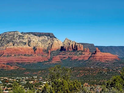
Airport Mesa
West Sedona · Trailhead / hiking area
WebsiteSedona hiking planner
Plan Sedona hikes by trail area, difficulty, parking and current conditions.
Explore · Interactive destination map
Use the map to find trail access areas by location, trail name or documented shuttle access. Trail difficulty, trail distance and shade open the documented hiking-route filters below. Map markers identify planning areas, not exact route starts or current trail conditions.
If the map is unavailable, choose a result below. Map markers are location references, not live conditions.
West Sedona · Trailhead / hiking area
Website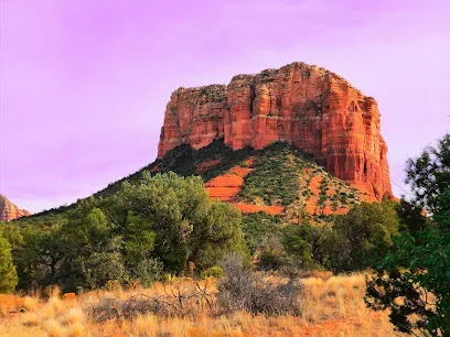
Village of Oak Creek · Trailhead / hiking area
Website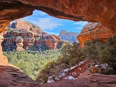
Oak Creek Canyon · Trailhead / hiking area
Website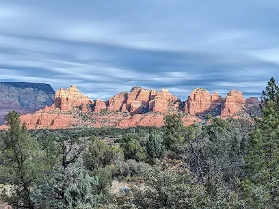
Chapel Area · Trailhead / hiking area
Website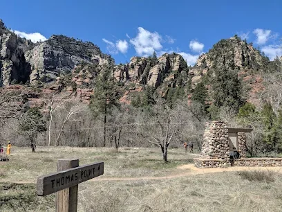
Oak Creek Canyon · Trailhead / hiking area
Website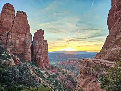
Chapel Area · Trailhead / hiking area
Website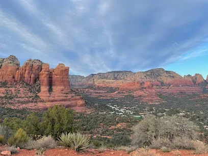
West Sedona · Trailhead / hiking area
Website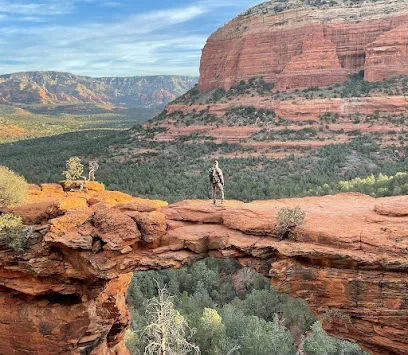
Oak Creek Canyon · Trailhead / hiking area
Website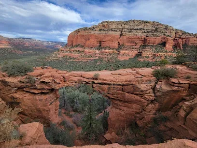
Oak Creek Canyon · Trailhead / hiking area
Website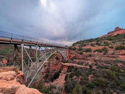
Uptown Sedona · Trailhead / hiking area
Website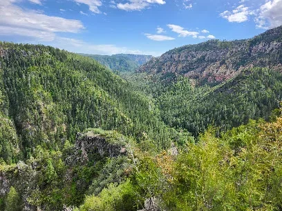
Oak Creek Canyon · Trailhead / hiking area
Website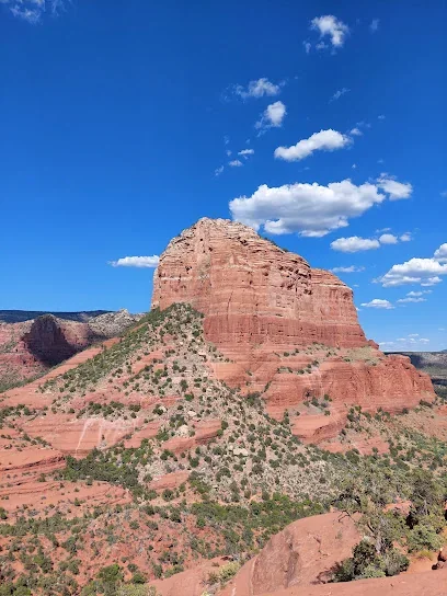
Village of Oak Creek · Trailhead / hiking area
Website
Central Sedona · Trailhead / hiking area
Website
West Sedona · Trailhead / hiking area
Website
West Sedona · Trailhead / hiking area
Website
West Sedona · Trailhead / hiking area
Website
Oak Creek Canyon · Trailhead / hiking area
Website
Village of Oak Creek · Trailhead / hiking area
WebsiteCompare Sedona, the Village of Oak Creek and Oak Creek Canyon hiking routes with published agency measurements. Filter by name, named-trail length, agency-rated difficulty and reviewed area labels. Trail segments often omit approaches and return distance; verify intended full hike and current access before leaving. Documented shuttle access and creek/scramble conditions are available for a reviewed subset; unknown is not the same as no.
Select routes using the Compare buttons below. Missing information means not reviewed, not that the route is easy, free, or safe. Selections remain while you adjust filters.
No routes selected
Trail status is not verified live here. Check current Coconino National Forest alerts and closures
Shuttle, parking, and trail-condition filters show only positively documented routes. Unclassified routes may have the same requirements or conditions; missing labels are not evidence of free parking, available shuttles, or an absence of hazards. Confirm posted parking rules, current schedules and alerts.
Areas are approximate editorial planning regions based on Forest Service trail maps; they are not official boundaries, exact access points, or estimates of driving distance.
38 documented routes shown
A demanding climb from Oak Creek Canyon toward the rim. Creek crossing, the long ascent and any road approach need to be considered separately from the guide’s trail length.
Oak Creek Canyon · 2.4 miles (published trail length) · Difficulty not rated in cited source · 2000 ft published elevation change (not total ascent)
USFS 2024 Red Rock Recreation Guide named-trail segment; not a parking-to-parking, out-and-back or whole-itinerary distance
Documented route condition: The Forest Service recreation partner identifies a creek crossing from Bootlegger Picnic Area to reach A.B. Young Trail. Conditions and water depth vary; do not assume a dry approach.
USFS Red Rock Recreation Guide (2024)Condition sourceA loop around Sedona Airport’s mesa with exposed sections and broad views; confirm the signed trail connection and parking access before setting out.
Central Sedona · 3.3 miles (published trail length) · Difficulty not rated in cited source · 200 ft published elevation change (not total ascent)
USFS 2024 Red Rock Recreation Guide trail-table length (named trail segment; not a parking-to-parking or round-trip estimate)
Documented route condition: Forest Service description states there is no shade until the last mile of the Airport Loop. Plan sun exposure and water needs accordingly.
USFS Red Rock Recreation Guide (2024)Condition sourceArea location sourceAirport Mesa is a nearby area reference, not an exact loop starting point.
A creek-side trail in lower Oak Creek Canyon. Review recreation-area access and avoid assuming that the published one-mile trail length is a round-trip from your parking place.
Oak Creek Canyon · 1.0 miles (published trail length) · Difficulty not rated in cited source · 70 ft published elevation change (not total ascent)
USFS 2024 Red Rock Recreation Guide named-trail segment; not a parking-to-parking, out-and-back or whole-itinerary distance
USFS Red Rock Recreation Guide (2024)Area location sourceA red-rock trail near the Cathedral Rock and Oak Creek corridor. The listed mileage describes the trail, not a complete outing with an approach and return.
Chapel / Red Rock Crossing · 1.6 miles (published trail length) · Difficulty not rated in cited source · 150 ft published elevation change (not total ascent)
USFS 2024 Red Rock Recreation Guide trail-table length (named trail segment; not a parking-to-parking or round-trip estimate)
USFS Red Rock Recreation Guide (2024)Area location sourceA steep, exposed route with a large published elevation change. The mileage is the listed trail length; plan the return separately and check weather and water requirements.
West Sedona · 2.5 miles (published trail length) · Difficulty not rated in cited source · 1800 ft published elevation change (not total ascent)
USFS 2024 Red Rock Recreation Guide trail-table length (named trail segment; not a parking-to-parking or round-trip estimate)
USFS Red Rock Recreation Guide (2024)Area location sourceA multiuse pathway in the Village of Oak Creek area. Published mileage covers the pathway, so shorter walks are possible without traveling its full length.
Village of Oak Creek · 3.7 miles (published trail length) · Difficulty not rated in cited source · 50 ft published elevation change (not total ascent)
USFS 2024 Red Rock Recreation Guide trail-table length (named trail segment; not a parking-to-parking or round-trip estimate)
USFS Red Rock Recreation Guide (2024)Area location sourceBell Rock Trailhead is an area reference; the pathway has multiple access points and a visitor may use only a portion.
A shorter loop in the Village of Oak Creek trail network. Verify the correct connection from your chosen access point instead of treating the reported length as parking-to-parking.
Village of Oak Creek · 1.0 miles (published trail length) · Difficulty not rated in cited source · 50 ft published elevation change (not total ascent)
USFS 2024 Red Rock Recreation Guide trail-table length (named trail segment; not a parking-to-parking or round-trip estimate)
Agency-published full outing: 1.0 miles. The Forest Service Courthouse Butte and Big Park trail guide lists the Big Park route at 1.0 mile round trip from its described Bell Rock pathway access. Verify the signed connection from your chosen parking area.
USFS Red Rock Recreation Guide (2024)Official complete-outing sourceBell Rock is a general access-area reference, not the mapped start of Big Park Loop.
A popular canyon approach with rock formations and changing light. The Forest Service guide lists the trail segment, not a guaranteed round-trip itinerary.
West Sedona · 2.5 miles (published trail length) · Difficulty not rated in cited source · 450 ft published elevation change (not total ascent)
USFS 2024 Red Rock Recreation Guide trail-table length (named trail segment; not a parking-to-parking or round-trip estimate)
USFS Red Rock Recreation Guide (2024)Area location sourceBoynton Canyon is the named area; check the signed trailhead and any connecting segments.
A mesa-and-canyon trail with a meaningful climb. Access may be via different trailheads and connecting paths; check the intended approach before comparing total mileage.
Uptown Sedona · 3.0 miles (published trail length) · Difficulty not rated in cited source · 600 ft published elevation change (not total ascent)
USFS 2024 Red Rock Recreation Guide trail-table length (named trail segment; not a parking-to-parking or round-trip estimate)
USFS Red Rock Recreation Guide (2024)Area location sourceA red-rock route shared with a busy recreation zone; stay on signed pedestrian trails and check the proper access rather than following OHV tracks.
Chapel / Red Rock Crossing · 1.5 miles (published trail length) · Difficulty not rated in cited source · 300 ft published elevation change (not total ascent)
USFS 2024 Red Rock Recreation Guide trail-table length (named trail segment; not a parking-to-parking or round-trip estimate)
USFS Red Rock Recreation Guide (2024)Area location sourceThe nearby map marker identifies the Broken Arrow area, not a GPS route line.
Steep ascent from the canyon corridor toward higher terrain. The sizeable published elevation change merits careful consideration of weather, footing and turnaround distance.
Oak Creek Canyon · 2.0 miles (published trail length) · Difficulty not rated in cited source · 1800 ft published elevation change (not total ascent)
USFS 2024 Red Rock Recreation Guide named-trail segment; not a parking-to-parking, out-and-back or whole-itinerary distance
USFS Red Rock Recreation Guide (2024)Area location sourceA short but sharply climbing slickrock route. A low distance does not indicate an easy hike; check weather, footwear, and the current shuttle/parking restrictions.
Chapel / Red Rock Crossing · 0.7 miles (published trail length) · Difficulty not rated in cited source · 600 ft published elevation change (not total ascent)
USFS 2024 Red Rock Recreation Guide trail-table length (named trail segment; not a parking-to-parking or round-trip estimate)
Documented access: City shuttle Route 15 serves Cathedral Rock Trailhead from North SR-179 Park & Ride. The trailhead's public parking closes while the shuttle runs; confirm the current service calendar and parking rules.
Documented route condition: Forest Service trail guidance describes a steep, exposed rock scramble. Short published mileage should not be interpreted as an easy hike.
USFS Red Rock Recreation Guide (2024)Access sourceCondition sourceArea location sourceCathedral Rock Trailhead is an access reference; the official mileage is the steep trail segment, not a round trip.
A trail segment in the Chapel area. Its listed length does not include parking access or combinations with nearby paths.
Chapel / Red Rock Crossing · 1.0 miles (published trail length) · Difficulty not rated in cited source · 100 ft published elevation change (not total ascent)
USFS 2024 Red Rock Recreation Guide trail-table length (named trail segment; not a parking-to-parking or round-trip estimate)
USFS Red Rock Recreation Guide (2024)Area location sourceA multiuse connector in the Dry Creek trail network. The trail-length figure does not specify your chosen approach or return.
West Sedona · 3.0 miles (published trail length) · Difficulty not rated in cited source · 200 ft published elevation change (not total ascent)
USFS 2024 Red Rock Recreation Guide trail-table length (named trail segment; not a parking-to-parking or round-trip estimate)
USFS Red Rock Recreation Guide (2024)Area location sourceMescal Trailhead is a nearby area reference only; confirm actual Chuckwagon junctions from an official trail map.
Short but notably steep canyon-rim ascent. The 0.7-mile figure is the listed segment, not the length of a Cookstove–Harding Springs combination hike.
Oak Creek Canyon · 0.7 miles (published trail length) · Difficulty not rated in cited source · 800 ft published elevation change (not total ascent)
USFS 2024 Red Rock Recreation Guide named-trail segment; not a parking-to-parking, out-and-back or whole-itinerary distance
USFS Red Rock Recreation Guide (2024)A route around Courthouse Butte near Bell Rock. A separate Forest Service route guide describes a 4.3-mile outing including access; do not confuse that with this 3.6-mile indexed trail length.
Village of Oak Creek · 3.6 miles (published trail length) · Difficulty not rated in cited source · 250 ft published elevation change (not total ascent)
USFS 2024 Red Rock Recreation Guide trail-table length (named trail segment; not a parking-to-parking or round-trip estimate)
Agency-published full outing: 4.3 miles. The Forest Service Courthouse Butte Loop guide describes a 4.3-mile round trip from the Bell Rock Vista/Bell Rock Pathway kiosk, including the connecting pathway; this is different from the 3.6-mile named-trail segment in the Red Rock Recreation Guide.
USFS Red Rock Recreation Guide (2024)Official complete-outing sourceBell Rock Trailhead is a nearby access reference; the 3.6-mile guide entry is a trail length, not the full linked hike.
A connector between the Long Canyon and Boynton Canyon trails. The Forest Service describes access via another trail, so visitors should not treat the 1.17-mile route length as a complete parking-to-parking hike.
West Sedona · 1.17 miles (published trail length) · Easy · 300 ft published ascent
USFS published one-way trail length; approaches from the parking area add distance
Documented parking / pass requirement: The Forest Service explicitly requires a Red Rock Pass or America the Beautiful Pass for parking at Boynton Canyon Trailhead, one access option for Deadmans Pass. This is not a blanket statement about all possible access points.
Official parking/pass sourceBoynton Canyon area reference, not the start of the Deadmans Pass trail segment; the official description explains the connecting approach.
A short official trail segment that can require a much longer approach on connecting routes. Choose legal parking or shuttle access and assess the exposed final section.
West Sedona · 0.8 miles (published trail length) · Difficulty not rated in cited source · 350 ft published elevation change (not total ascent)
USFS 2024 Red Rock Recreation Guide trail-table length (named trail segment; not a parking-to-parking or round-trip estimate)
Documented access: The city shuttle serves Dry Creek Vista and Mescal access areas, not Devil's Bridge itself. Additional connecting trails or road walking are required, so the short named-trail mileage is NOT the entire hike from the shuttle stop.
USFS Red Rock Recreation Guide (2024)Access sourceArea location sourceThe nearby marker is a general trailhead/area reference; the 0.8-mile figure excludes approach from most parking options.
A relatively short ascent to a mesa top, with a significant climb relative to the mileage. The 0.7-mile figure is not a complete return trip.
West Sedona · 0.7 miles (published trail length) · Difficulty not rated in cited source · 400 ft published elevation change (not total ascent)
USFS 2024 Red Rock Recreation Guide trail-table length (named trail segment; not a parking-to-parking or round-trip estimate)
USFS Red Rock Recreation Guide (2024)Area location sourceA connector within the Cathedral Rock-side trail network. Do not use its name as an agency difficulty grade; the cited guide does not publish one in the distance table.
Chapel / Red Rock Crossing · 1.2 miles (published trail length) · Difficulty not rated in cited source · 240 ft published elevation change (not total ascent)
USFS 2024 Red Rock Recreation Guide trail-table length (named trail segment; not a parking-to-parking or round-trip estimate)
USFS Red Rock Recreation Guide (2024)Area location sourceCathedral Rock is an area reference only; Easy Breezy has separate junctions and approaches.
A canyon trail in the west Sedona area. The 1.1-mile published segment should not be doubled or extended without identifying the actual route you plan to walk.
West Sedona · 1.1 miles (published trail length) · Difficulty not rated in cited source · 150 ft published elevation change (not total ascent)
USFS 2024 Red Rock Recreation Guide trail-table length (named trail segment; not a parking-to-parking or round-trip estimate)
USFS Red Rock Recreation Guide (2024)Area location sourceA trail with Oak Creek-area scenery; access from different points can change the length of an outing. The listed figure describes the named trail.
Uptown Sedona · 2.6 miles (published trail length) · Difficulty not rated in cited source · 170 ft published elevation change (not total ascent)
USFS 2024 Red Rock Recreation Guide trail-table length (named trail segment; not a parking-to-parking or round-trip estimate)
USFS Red Rock Recreation Guide (2024)Area location sourceA connector through the Bell Rock trail network used by hikers and mountain bikers. Use the Forest Service description to distinguish the Llama Trail from the Bell Rock Pathway and choose an appropriate access point.
Village of Oak Creek · 2.8 miles (published trail length) · Moderate · 200 ft published ascent
USFS published trail length; a complete hike may include access trails or a return trip
Documented parking / pass requirement: The Forest Service requires a Red Rock Pass or America the Beautiful Pass when parking at the listed trailhead. The route can be accessed from Bell Rock Vista or Little Horse; verify the exact lot and current signs.
Official parking/pass sourceBell Rock area reference only; consult the official trail description for the actual Llama Trail access points.
A trail corridor with views of the formations east of central Sedona. The published named-trail mileage should not be mistaken for a particular parking-to-parking circuit.
Central Sedona · 2.0 miles (published trail length) · Difficulty not rated in cited source · 100 ft published elevation change (not total ascent)
USFS 2024 Red Rock Recreation Guide named-trail segment; not a parking-to-parking, out-and-back or whole-itinerary distance
USFS Red Rock Recreation Guide (2024)Area location sourceA west-side trail near the Mescal access area; it intersects a wider network, so planned distance depends on chosen approach and connections.
West Sedona · 2.6 miles (published trail length) · Difficulty not rated in cited source · 220 ft published elevation change (not total ascent)
USFS 2024 Red Rock Recreation Guide named-trail segment; not a parking-to-parking, out-and-back or whole-itinerary distance
Documented access: City shuttle Route 11 serves Mescal Trailhead from West SR-89A Park & Ride. Seasonal schedule adjustments can shorten service, so confirm the day's last return before departing.
USFS Red Rock Recreation Guide (2024)Access sourceArea location sourceA substantial climb near the Oak Creek Canyon end of the Wilson Mountain trail system. Do not confuse this route with Wilson Mountain Trail’s separate published mileage.
Oak Creek Canyon · 2.0 miles (published trail length) · Difficulty not rated in cited source · 1450 ft published elevation change (not total ascent)
USFS 2024 Red Rock Recreation Guide named-trail segment; not a parking-to-parking, out-and-back or whole-itinerary distance
USFS Red Rock Recreation Guide (2024)Area location sourceA trail within the south-side Bell Rock/Village network. Cross-check your starting trailhead and selected connectors before turning its listed segment distance into a hike plan.
Village of Oak Creek · 2.5 miles (published trail length) · Difficulty not rated in cited source · 220 ft published elevation change (not total ascent)
USFS 2024 Red Rock Recreation Guide named-trail segment; not a parking-to-parking, out-and-back or whole-itinerary distance
USFS Red Rock Recreation Guide (2024)A popular corridor passing distinctive rock features. Check Sedona Shuttle trailhead access and do not treat the trail mileage as an entire connected loop.
West Sedona · 2.4 miles (published trail length) · Difficulty not rated in cited source · 450 ft published elevation change (not total ascent)
USFS 2024 Red Rock Recreation Guide trail-table length (named trail segment; not a parking-to-parking or round-trip estimate)
Documented access: City shuttle Route 14 serves Soldier Pass Trailhead from Posse Grounds Park & Ride. The trailhead parking area closes while the shuttle is operating; verify seasonal service and gate restrictions.
USFS Red Rock Recreation Guide (2024)Access sourceArea location sourceSoldier Pass Trailhead is an access reference, not a guarantee of available parking or a current shuttle stop.
A pass crossing with substantial elevation change. Determine which side of the pass you will start on and confirm legal parking and your return before hiking.
Oak Creek Canyon · 2.4 miles (published trail length) · Difficulty not rated in cited source · 1100 ft published elevation change (not total ascent)
USFS 2024 Red Rock Recreation Guide named-trail segment; not a parking-to-parking, out-and-back or whole-itinerary distance
USFS Red Rock Recreation Guide (2024)A short loop option in west Sedona. The loop and the separate summit spur have different lengths; verify which path you intend to follow.
West Sedona · 0.5 miles (published trail length) · Difficulty not rated in cited source · 50 ft published elevation change (not total ascent)
USFS 2024 Red Rock Recreation Guide trail-table length (named trail segment; not a parking-to-parking or round-trip estimate)
USFS Red Rock Recreation Guide (2024)Area location sourceSugarloaf Trailhead is the general area reference; distinguish the signed loop from Sugarloaf Summit.
A connecting trail beneath Sedona’s red rocks. The 3.5-mile official entry is the trail segment length, not a complete loop or a route to Cathedral Rock’s summit.
Chapel / Red Rock Crossing · 3.5 miles (published trail length) · Difficulty not rated in cited source · 250 ft published elevation change (not total ascent)
USFS 2024 Red Rock Recreation Guide trail-table length (named trail segment; not a parking-to-parking or round-trip estimate)
USFS Red Rock Recreation Guide (2024)Area location sourceCathedral Rock Trailhead is an area reference only; Templeton has multiple junctions and access choices.
Steep ascent on the east side of Oak Creek Canyon. The guide’s one-mile distance covers the named trail, not an automatically completed loop or return.
Oak Creek Canyon · 1.0 miles (published trail length) · Difficulty not rated in cited source · 850 ft published elevation change (not total ascent)
USFS 2024 Red Rock Recreation Guide named-trail segment; not a parking-to-parking, out-and-back or whole-itinerary distance
USFS Red Rock Recreation Guide (2024)A west-Sedona trail segment linking nearby paths. Confirm the specific route and endpoints to avoid conflating the trail with surrounding loops.
West Sedona · 1.0 miles (published trail length) · Difficulty not rated in cited source · 50 ft published elevation change (not total ascent)
USFS 2024 Red Rock Recreation Guide trail-table length (named trail segment; not a parking-to-parking or round-trip estimate)
USFS Red Rock Recreation Guide (2024)Area location sourceThunder Mountain Trailhead is a general access reference rather than a verified start for the full trail segment.
A trail in the southern Sedona/Village corridor. Check connecting trails and access carefully because the published trail length is not a prescribed visitor loop.
Village of Oak Creek · 3.0 miles (published trail length) · Difficulty not rated in cited source · 600 ft published elevation change (not total ascent)
USFS 2024 Red Rock Recreation Guide named-trail segment; not a parking-to-parking, out-and-back or whole-itinerary distance
USFS Red Rock Recreation Guide (2024)Forested creek-side canyon with repeated water crossings. Check current Forest Service closures, flooding, fire effects and day-use access before making plans; this is NOT an open-status confirmation.
Oak Creek Canyon · 3.0 miles (published trail length) · Difficulty not rated in cited source
Recreation.gov describes the first approximately 3 miles as marked and maintained, one way. A return on the same trail would add approximately 3 miles; full-canyon travel is a separate, substantially more serious undertaking.
Documented route condition: The federal recreation description documents repeated crossings along the maintained first three miles. Footing and water levels vary; the deeper wilderness route is a different, much more demanding outing.
Condition sourceLong, strenuous-feeling ascent by published elevation change alone; plan separately for the return, seasonal conditions, route junctions and potential canyon access constraints.
Oak Creek Canyon · 5.6 miles (published trail length) · Difficulty not rated in cited source · 2400 ft published elevation change (not total ascent)
USFS 2024 Red Rock Recreation Guide named-trail segment; not a parking-to-parking, out-and-back or whole-itinerary distance
USFS Red Rock Recreation Guide (2024)An extended route east of the Village of Oak Creek. Confirm the appropriate access point and water availability; the listed mileage does not necessarily describe a full out-and-back hike.
Village of Oak Creek · 4.3 miles (published trail length) · Difficulty not rated in cited source · 400 ft published elevation change (not total ascent)
USFS 2024 Red Rock Recreation Guide named-trail segment; not a parking-to-parking, out-and-back or whole-itinerary distance
USFS Red Rock Recreation Guide (2024)The Forest Service describes a short out-and-back scenic walk suitable for varied experience levels. It is a separate route from Bell Rock Trailhead and should not be combined with that trail's mileage.
Village of Oak Creek · 0.5 miles (published trail length) · All skill levels
USFS describes a 0.5-mile out-and-back walk
Documented parking / pass requirement: The Forest Service requires a Red Rock Pass or America the Beautiful Pass to park at Yavapai Vista. The published 0.5-mile route is an out-and-back; parking rules remain subject to posted notices.
Official parking/pass sourceBell Rock-area reference only, not the Yavapai Vista trailhead. Check the source for the route's own location.
Published route data is not a current trail-condition report, GPS track, travel time estimate, or parking-to-parking mileage. Difficulty is shown only when documented in the cited source. Check the managing agency before departure.
Popular trail areas
Cathedral Rock, Bell Rock, Devil’s Bridge, Soldier Pass, Boynton Canyon and West Fork each create a different day. Compare exposure, scrambling, shade, creek access and likely parking pressure before selecting a route.
Parking strategy
High-demand trailheads may have restricted parking or seasonal shuttle service. Check the City of Sedona trailhead-shuttle information and keep a second trail area in the plan rather than circling a full lot.
Safety
Carry more water than an urban walk requires, avoid committing to exposed routes during thunderstorms, and turn around when pace, heat or route-finding no longer matches the group. Verify closures and fire restrictions before departure.
Passes
Some Red Rock recreation sites require a Red Rock Pass or another accepted federal recreation pass. The requirement varies by site, so confirm it for the exact destination rather than assuming one rule covers every trailhead.
Current-source checklist
A static guide cannot confirm today’s closure, fire restriction, weather or shuttle operation. Check the source responsible for each decision, save the route offline, and keep a lower-exposure alternative.
Compare before you choose
Use this comparison to narrow the kind of outing, then verify the exact route and access rules using the official resources below. These are general characteristics, not current trail conditions or guaranteed accessibility.
| Trail area | Best suited for | Watch for | Plan before leaving |
|---|---|---|---|
| Bell Rock | Flexible red-rock scenery and a choice of walking routes | Exposed terrain and route choices near the formation | Choose a specific signed route and legal parking area |
| Cathedral Rock | Steeper rock terrain for confident hikers | Scrambling and exposed sections | Check trailhead access and shuttle operations |
| Devil’s Bridge | A distinctive rock-bridge destination | Popular access routes and narrow viewpoints | Confirm approach distance, trailhead and parking rules |
| West Fork | Oak Creek Canyon scenery and a more shaded setting | Creek crossings, water and seasonal conditions | Check fee, access and weather before driving into the canyon |
| Boynton Canyon | A canyon hike with changing red-rock scenery | Length, exposure and route selection | Choose a turnaround point appropriate for your group |
Decision rule: If parking, weather or the group's fitness is uncertain, pick one primary hike and one lower-commitment alternative nearby. Do not treat a map pin or a general trail name as proof of legal access.
Detailed activity planning
Evaluate distance, elevation, exposure, scrambling, navigation and turnaround points separately. A short trail can be more demanding than a longer smooth route. Select for the least experienced participant and decide what conditions will trigger an early return.
Carry offline navigation and do not depend on a crowd to identify the route. Stay on established surfaces and avoid widening wet or damaged trail.
Identify the exact trailhead, legal parking or park-and-ride, pass requirement and shuttle schedule. Popular names can have multiple approaches, and a saved pin does not establish permission to park. Keep a lower-demand backup in the same area.
If the lot is full, do not create a roadside space or block emergency access. Use the shuttle where it serves the route or move to the planned alternative.
Check heat, lightning, flash-flood, ice, smoke and fire information for the day and terrain. Start earlier or shorten the route when exposure increases. Avoid narrow drainages during storm risk and shaded winter terrain when ice would create unacceptable consequences.
The safest decision is often made before leaving lodging. Establish a forecast or temperature threshold that changes the plan.
Carry water, food, sun protection and layers for every participant. Tell someone the route and return window. Keep children and dogs directly controlled around edges, wildlife and other users, and pack out every item including pet waste.
A successful hike ends with the complete group returning safely; the named viewpoint is optional.
When the morning anchor depends on parking, shuttle timing, weather and the group’s pace, keep the afternoon flexible and nearby. Two famous hikes in different areas create pressure to rush, park poorly or continue after fatigue. A shorter same-area walk, meal or viewpoint is a better second block. Record the exact route, access method, turnaround time and backup before departure so the group is deciding from a plan rather than from a full parking lot.
Optional lodging comparison
A practical location can reduce early-morning driving and repeated trips through Sedona’s busiest corridors.
Paid affiliate link. We may earn a commission if you complete a qualifying booking. Compare the total price, location and cancellation terms directly with the provider.